
Mountain Odyssey Maps
MAP ARCHIVE |
|
UNITED STATES FOREST SERVICE |
|
Adobe Reader is needed to view these maps. Get Adobe Reader at http://www.adobe.com/products/acrobat/readstep2.html |
|
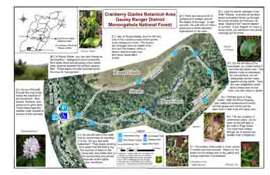
This visitors map (pdf 2.8MB) Printing Tip-All maps on this page are made to be printed on 11X17 in. paper except the Falls of Hills Creek and the Elkins visitors maps that are made for 8.5X11 in. paper. To print the 11X17 in. on 8.5X11 in. paper set the page scaling in the Adobe Reader print dialog box to (Reduce to Printer margins). |
 |
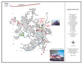
| This visitors map (pdf 1.1MB) is of the town of Elkins WV. The Monongahela National Forest headquarters and supervisor's office is located in Elkins. For more information on the Monongahela National Forest click here. |
 |
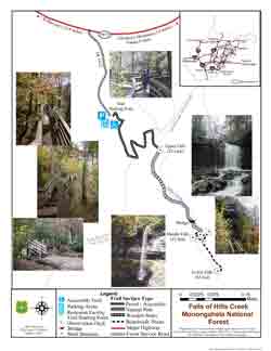
| This visitors map (pdf 3.3 MB) is of the Falls of Hills Creek Area that is along the Highlands Sceinic Highway west of the Cranberry Mountain Nature Center. For more information on this area click here. |
 |
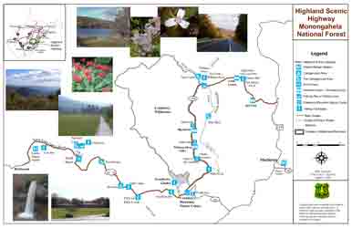
| This visitors map (pdf 4.5 MB) is of the Highlands Scenic Higway. For more information on this area click here. |
 |
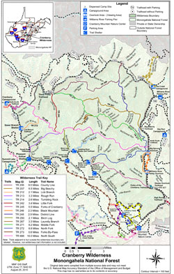
| This trail map (pdf 1.4MB) is for the Cranberry Wilderness.
The Monongahela National Forest has put out a new brochure on Cranberry Wilderness |
 |
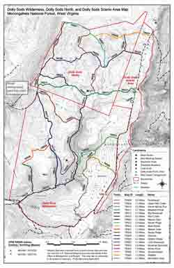
| This trail map (pdf 2.1MB) is for the Dolly Sods Area.
For more information on this area click here. The Monongahela National Forest has put out a new brochure on Dolly Sods Wilderness. |
 |
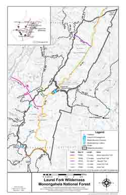
| This trail map (pdf 1.9MB) is for the Laurel Fork Wilderness area.
For more information on this area click here. The Monongahela National Forest has put out a new brochure on Laurel Fork Wilderness. |
 |
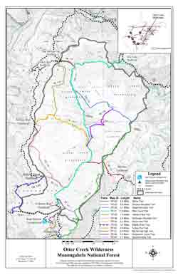
| This trail map (pdf 1.4MB) is for the Otter Creek Wilderness.
For more information on this area click here. The Monongahela National Forest has put out a new brochure on Otter Creek Wilderness. |
 |
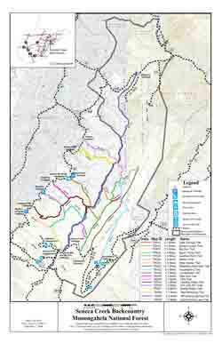
| This trail map (pdf 2MB) is fo the Seneca Creek Backcountry.
For more information on this area click here. |
 |