
Mountain Odyssey Maps
MAP ARCHIVE |
||
MONONGAHELA NATIONAL FOREST |
||
| Adobe Reader is needed to view these maps. Get Adobe Reader at http://www.adobe.com/products/acrobat/readstep2.html All maps are made to be printed on letter size paper (8.5X11.0 inches). Please follow the printing instructions on the first page of each map set. Make sure you have the Adobe Reader print dialog set to the page you want to print. You can save a copy of each map set on your computer by clicking the save button on the Adobe Reader tool bar. |
||
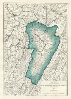
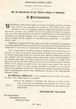
| This map(pdf 2.4 MB) and proclamation(pdf 1.2 MB) are copies of the originals from 1920 These documents were reproduced by the US Forest Service-Monongahela National Forest, GIS Staff (March, 2006) |
 |
 |
| This document(pdf 2.1MB) contains a list and maps of the tracts of land in the Monongahela National Forest that were part of the proposed land sale by the US Government in March, 2006 |  |
|
| This is a map(pdf 211KB) of the West Virginia Wilderness Coalition's proposed wilderness areas | 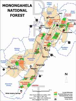 |
|
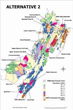
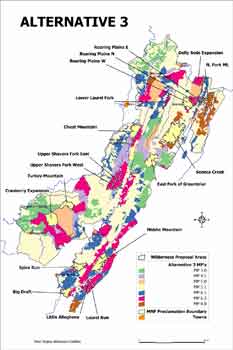
| This document(pdf 407KB) contains two maps of the MNF Forest Plan alternatives that have the West Virginia Wilderness Coalitions proposed wilderness areas on them |
 |
 |
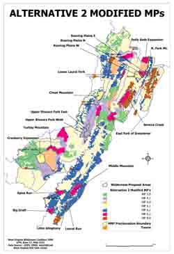
| This document(pdf 432KB) contains one maps of the MNF Forest Plan Alternative 2 Modified that have the West Virginia Wilderness Coalitions proposed wilderness areas on them |
 |
|
MORE MAPS |
||
Dolly Sods, Roaring Plains 24K Trail Maps |
||
Seneca Creek 24K Trail Maps |
||
Otter Creek Wilderness 24K Trail Maps |
||
Tea Creek 24K Trail Maps |
||
Cranberry Wilderness 24K Trail Maps |
||
North Fork Mountain 24K Trail Maps |
||
Dolly Sods Maps From the Original Wilderness Proposal |
||
Surface Mining in the Southern Counties of WV |
||
USFS Monongahela National Forest Visitors and Trail Maps |
||
Last Update
Sunday, June 15, 2008 9:55 AM
West Virginia Highlands Conservancy ©2007-2013 - Site Design by Jim Solley