MONONGAHELA NATIONAL FOREST
Adobe Reader is needed to view these maps. All maps are made to be printed on letter size paper (8.5X11.0 inches). Please follow the printing instructions on the first page of each map set. Make sure you have the Adobe Reader print dialog set to the page you want to print. You can save a copy of each map set on your computer by clicking the save button on the Adobe Reader tool bar.
Printing Tip-All maps on this page are made to be printed on 11X17 in. paper except the Falls of Hills Creek and the Elkins visitors maps that are made for 8.5X11 in. paper. To print the 11X17 in. on 8.5X11 in. paper set the page scaling in the Adobe Reader print dialog box to (Reduce to Printer margins)

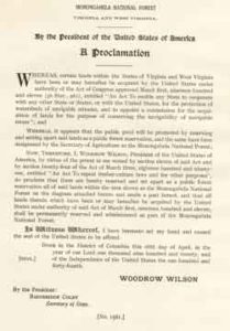 This map and proclamation are copies of the originals from 1920
These documents were reproduced by the US Forest Service-Monongahela National Forest, GIS Staff (March, 2006)
This document contains a list and maps of the tracts of land in the Monongahela National Forest that were part of the proposed land sale by the US Government in March, 2006
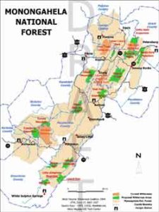 This is a map of the West Virginia Wilderness Coalition’s proposed wilderness areas
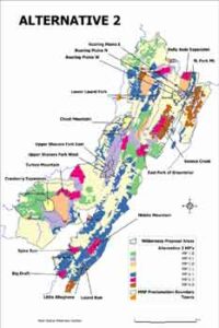
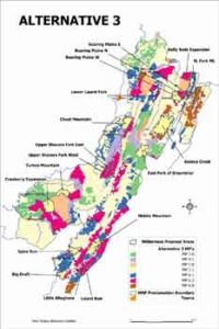 This document contains two maps of the MNF Forest Plan alternatives that have the West Virginia Wilderness Coalitions proposed wilderness areas on them
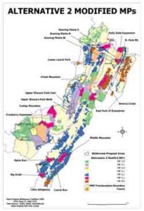 This document contains one map of
the MNF Forest Plan Alternative 2 Modified that have the West Virginia Wilderness Coalitions proposed wilderness areas on them