By George E. Beetham Jr
Before the coming of European explorers and settlers, all of the land in what is now West Virginia was wilderness. Much of the land defied travel. Mountain slopes, laurel thickets (called laurel hells by later settlers), bogs, and forests of red spruce growing so thick a person could scarcely squeeze through all tested the mettle and determination of the hardiest explorer.
One such explorer was Thomas Lewis, who, along with Peter Jefferson (father of Thomas), set out to establish the Fairfax Line in 1746. Lewis noted in his journal:
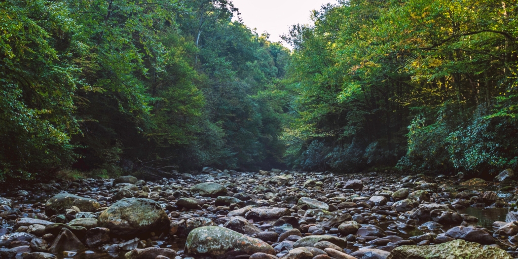
”The laurel, ivy and spruce pines so extremely thick in the swamp through which the river runs that one cannot have the least prospect except he look upwards. The water of the river of a dark brownish color, and its motion so slow that it can hardly be said to move.”
That reality notwithstanding, settlers came and farmed the land, slowly eating away at the wilderness. In the late 19th Century, timber and coal companies came. The virgin forest was cut from the mountains. They left behind virtually total destruction. Forest fires finished off the work. One small parcel was left untouched through a surveyor’s error: now the Gaudineer Scenic Area near 250.
The environment havoc complete, the federal government acquired much of the land and established the Monongahela National Forest. Under its protection, the land recovered. By the mid-20th Century, a lot of the forest had returned to wilderness conditions. About the same time, recreational use of the forest began to increase. A movement to protect newly established wilderness resulted in the Wilderness Act of 1965.
The fact that much of the Monongahela National Forest is designated as federal wilderness is due in large part to the Highlands Conservancy’s leadership and partnerships with other environmental groups, businesses, faith organizations and others. Many of our members also participated in one way or another in the recent efforts for more wilderness in West Virginia—efforts that paid off with the enactment of the Wild Monongahela Act passed in 2009 and signed into law by President Barack Obama.
Until passage of that act, West Virginia’s wilderness areas came in two distinct efforts. Dolly Sods (embracing the Red Creek area on the south of Dolly Sods) and Otter Creek were designated in 1975 as part of the Eastern Wilderness Areas Act. Laurel Fork North and South, and Cranberry were designated in a separate piece of legislation in 1983.
Conservancy members were active in documenting the areas proposed for wilderness, lobbying, and working toward wilderness.
After a 26-year drought in new Wilderness designations, the Wild Monongahela Act expanded three existing Wilderness Areas; Dolly Sods, Cranberry, and Otter Creek, and it also created three new Areas; Roaring Plains West, Big Draft, and Spice Run, totaling nearly 40,000 acres.
Highlands Conservancy members participated in field surveys and inventories to gather information to form a citizen’s Wilderness proposal called A Vision for a Wild Mon. It was a successful result of a strategic campaign coordinated by the Wilderness Coalition.
This was a loosely knit coalition made up of the Highlands Conservancy, West Virginia Chapter of the Sierra Club and the Wilderness Society. Supporters lobbied lawmakers, responded to challenges in the press and in governmental proceedings, and participated in public information meetings. The Highlands Conservancy’s Fall Reviews often served as Campaign promotional events at such legendary locations as the Elk River Inn at Slaty Fork, or at the historic Cheat Mountain Club.
The newly designated Areas provided by the Wild Mon Act were sorely needed, both to preserve ecologically unique areas and also to provide more wilderness recreational opportunities. The fact was, parts of the existing wilderness areas were being loved to death by hikers and backpackers. The new Wilderness Areas cover a wealth of ecosystems from the broad plains of Dolly Sods and Roaring Plains to the biologically unique areas of Spice Run and Big Draft. Much of the new wilderness will get visited infrequently. Other areas will quickly draw recreational use.
Dolly Sods North, for example, was drawing visitors long before it was acquired by the National Forest Service. Roaring Plains was another popular hiking destination all the way out to Mount Porte Crayon, a trailless peak named after David Hunter Strother’s nom de plume for articles and artwork published in 19th Century periodicals (Porte crayon is French for pencil case).
The Wilderness Areas of the Monongahela National Forest offer hiking, hunting, fishing, berry picking and more. People can stay multiple nights or take day hikes. There are peaks, forest cover, open plains, unique bogs, and more. Photographers find open vistas and the opportunity to capture both plant and animal life up close. Besides trails, hikers can strike out cross-country if they are experienced in land navigation and map reading.
There are historically rich logging areas where geared steam locomotives once pulled long trains down to lumber mills. Dolly Sods North was used for mortar practice during World War II, and old mortar shells are still sometimes found there (anyone discovering such a shell should leave it there without touching it, leave a flag nearby, and report the location to the district ranger in Petersburg). In some places, homesteads and other ruins can be found, evidence that our eastern wilderness has been recycled.
Highlands Conservancy members can feel proud that they provided much of the leadership, perseverance, and hard work necessary to bring this wilderness into being. In many ways, it was a model of collaboration with other organizations, the Monongahela National Forest staff, and the Mountain State’s representatives in Congress. The act is a tangible accomplishment that will last long into the future, protecting watersheds, forests, and habitats for wildlife and plants. It embraces unique geological features and climate zones. At times, the Monongahela makes its own weather as fronts move from northwest to southeast, and wind currents are compressed as they pass up the western slopes of mountains. The Monongahela is classified as a temperate rainforest because of this.
Thanks to the protection afforded by the Wilderness Act and the hard work of the West Virginia Highlands Conservancy, it is possible to find places where the conditions described by Thomas Lewis have returned.
Conservancy members can explore and find the conditions by visiting the Wilderness Areas of the Mon. Your best source of information is the Monongahela National Forest Hiking Guide, published by the Highlands Conservancy, now in its ninth edition. You can obtain maps and other information at district ranger centers, visitor centers at Seneca Rocks and near the Cranberry Glades, or from the forest headquarters in Elkins. Rangers will be happy to answer questions and help make your trip a success.
Dave Saville, who was among the leaders in bringing the Wild Monongahela Act of 2009, contributed to this article. This article first appeared in the September 2017 issue of The Highlands Voice.

