By Hugh Rogers
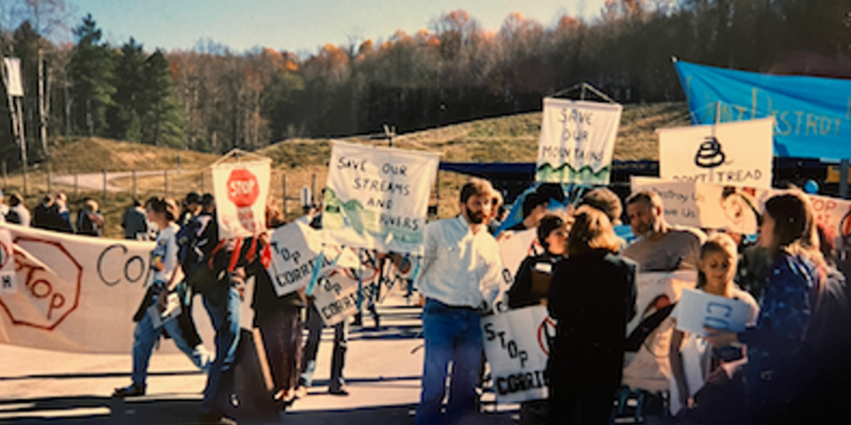
In mid-October, the West Virginia Highlands Conservancy held its 59th annual Fall Review at Cacapon State Resort Park. Over the years, the organization has addressed many threats to the Highlands – dams, strip mines, clear-cutting, and more – but one topic has been perennial: Corridor H, the proposed, and now nearly completed, Appalachian Development Highway.
Conservancy members and guests heard a presentation on the history and present situation from Hugh Rogers, chair of the Conservancy’s Highways Committee, along with Pam Moe of Corridor H Alternatives and Bonni McKeown of Stewards of the Potomac Highlands.
Corridor H (now US 48) was originally intended to connect I-79 at Weston, West Virginia, to I-81 in Virginia. While Virginia vetoed its fifteen-mile portion, the West Virginia Division of Highways (DOH) insisted it wouldn’t quit until it reached the state line. An Environmental Assessment (EA) for the six-mile section from Wardensville to the border is due this month.
The other segment without a final route, ten miles from Parsons to Davis, will get its Draft Environmental Impact Statement (an EIS is more complex than an EA) somewhat later. Opponents to the highway department’s Preferred Alignment have been urging it to go north around the town of Thomas, rather than between Thomas and Davis.
Go North has been a long-running demand. In 1965, the proposed alternatives all went east from Elkins, and would have run over or passed near Dolly Sods, not yet a protected wilderness area. Arch Moore, governor in the early 70’s, grew impatient with disagreements over the route. He ordered construction to begin willy-nilly from Elkins east to Alpena. At Bowden, road-building dynamite destroyed the spring that fed a federal fish hatchery. Further construction was stopped; the northern alternative was revived.
One EIS followed another in the 70’s and 80’s. Opponents’ hopes rose when the Environmental Protection Agency’s regional office rated the entire project “EU” – environmentally unsatisfactory. Would the DOH go back to the drawing board? Not while Senator Byrd and Governor Rockefeller could pressure the Clinton administration to fire Regional Administrator Peter Kostmayer.
Finally, in 1996, the Federal Highway Administration signed off on the selection of a northern route via Parsons, Davis, Moorefield, and Wardensville. That EIS had many flaws, however, and the West Virginia Highlands Conservancy, Corridor H Alternatives (the lead plaintiff), and thirteen co-plaintiffs sued to block it.
Judges were no more willing than politicians to second-guess the highway engineers’ choices re: streams, wetlands, wildlife habitat, and other natural resources. But the engineers’ failure to take seriously the area’s historic sites gave opponents a temporary victory. The Court of Appeals then ordered the parties to engage in mediation with a court-employed facilitator. In early 2000, a Settlement Agreement was signed by the plaintiffs and the state and federal highway agencies. The Agreement controlled further construction on 40% of the route.
Civil War battlefields at Moorefield and south of Parsons have been avoided. Since 2000, the highway has been completed west from Wardensville, past Moorefield, to Davis, a distance of 68 miles. Now DOH contractors are working east from Elkins to a Cheat River crossing near Parsons. The new alignment is severely impacting Monongahela National Forest lands and waters.
So: from east and west, Corridor H approaches the missing link. How will it affect the tourist-friendly towns of Davis and Thomas? How will it help the visitors who want to shop, dine, hear music, and stay to enjoy skiing, biking, and historic sites, while diverting long-distance truck traffic from Thomas’s narrow streets?
The Go North Alliance includes a large majority of local business owners along with environmental activists. They want a bypass that will carry through traffic while allowing visitors easy access. They want a greenway connecting the two towns, not a four-lane divider between them. They want to preserve the Blackwater Industrial Complex, a historic district from Thomas south along the North Fork of the Blackwater and into the dramatic Blackwater Canyon. It’s pretty simple.
The DOH has offered a two-lane Truck Route from US 219 north of Thomas straight down to WV 32. There, trucks would tangle with local traffic until they reached another intersection that would enable them to continue to other destinations. For the main route, DOH’s preference remains the same: a straight shot that bridges the Blackwater and divides the towns.
The Blackwater Historic District has been found eligible for the National Register of Historic Places, and thus is protected from “substantial impairment” by federal transportation law. The DOH must consider whether any alternative route is “feasible and prudent.”
The basic outline of the northern route, first set out more than twenty years ago, was approved by state and federal environmental agencies, but the DOH rejected it. The Federal Highway Administration did not sign off on their preferred alternative. Now FHWA has required the DOH to re-consider the northern alternative.
Meanwhile, Wardensville was left alone for twenty-five years as Corridor H began on its west side. The first town in West Virginia to receive travelers on this route, it has benefited from the delay with new businesses and attractions. The only reason to build back up to the state line would be a supposed change in the Level of Service, based on inflated predictions of traffic when the corridor is complete. The cost would be high: impacts to the George Washington National Forest (trout streams, rare species, flood protection), the town’s water supply, and the town itself. A few improvements to WV 55 would be more than enough. Sometimes the smartest course is to keep on the same course.

