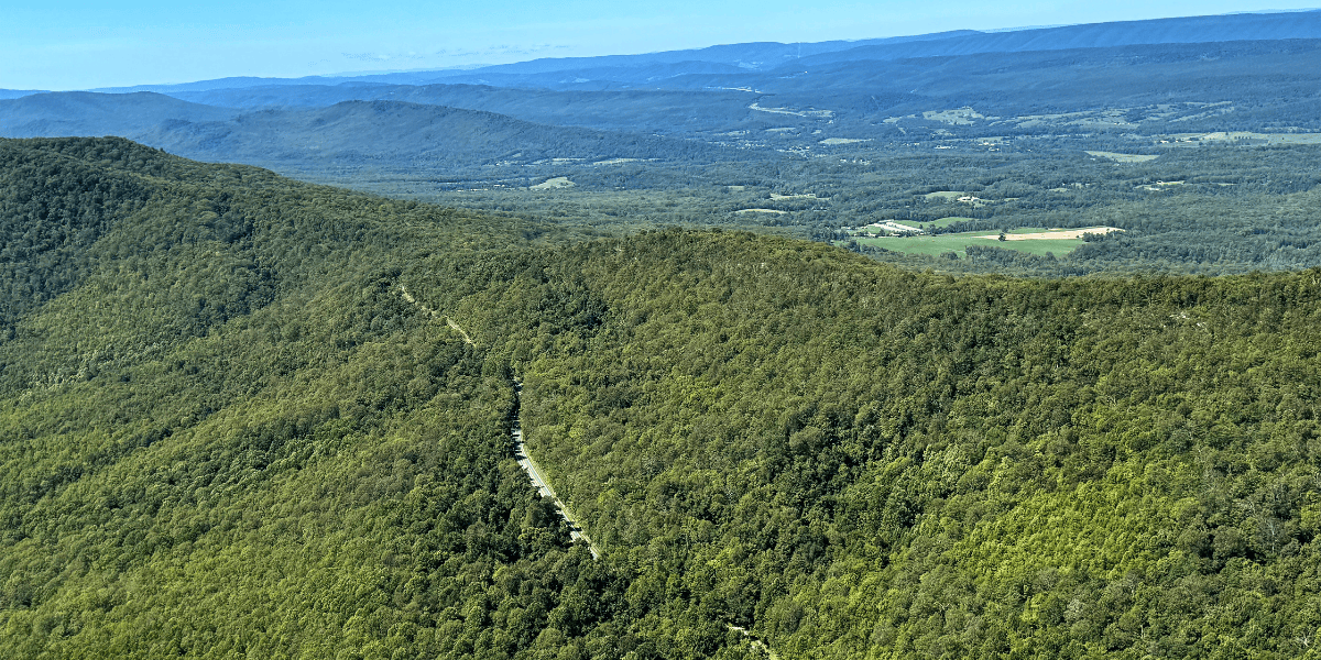
Route 55 carves through the George Washington National Forest, with a sweeping view of the vast roadless area along the mountain chain to the left—a Virginia Mountain Treasure. In the distance, you can catch a glimpse of Wardensville and the controversial Corridor H. (Photo by the Allegheny-Blue Ridge Alliance)
By Hugh Rogers and Bonni McKeown
West Virginia’s controversial Corridor H highway will be debated once again. The state Division of Highways plans to issue environmental documents soon on two remaining sections in Tucker and Hardy County known for pristine streams, steep slopes, and diverse plant and animal species—Parsons to Davis and Wardensville to the Virginia line.
The costly mountain-crossing four-lane is part of the 1960s Appalachian Development Highways program, originally intended to connect I-79 at Weston, West Virginia, to I-81 in Virginia. The 68 miles already built between Elkins and the west end of Wardensville, known as US 48, have cost almost $2 billion, and the remaining two are slated to cost another billion.
Virginia’s Commonwealth Transportation Board vetoed its 15-mile portion nearly thirty years ago, and CTB spokesman Marshall Herman told the Charleston Gazette in January 2024 that Virginia still has no plans to build it. Environmental groups and many local residents call the project a “Road to Nowhere.”
Nevertheless, outgoing West Virginia Governor (and US Senate candidate) Jim Justice and WVDOH Highway Commissioner Jimmy Wriston, plus US Sen. Shelley Moore Capito, have been pushing to build to the state line alongside existing Route 55, claiming an increase in traffic would then force Virginia to build its section. Current traffic volume on WV and Va. 55 is less than 5,000 vehicles daily, which in no way justifies a four-lane.
New regulations also require a study of how new highway projects would affect climate change—by destruction of forest and field cover, and by encouragement of more automobile driving. Because the whole region is environmentally sensitive and was one of the first areas settled in West Virginia, any Corridor H route impacts streams, wetlands, wildlife habitat and historic areas.
WVDOH officials have indicated they expect to issue an Environmental Assessment on the 6.8-mile section from Wardensville to the border this month, and an Environmental Impact Statement for the 10-mile Parsons to Davis section sometime later in the year. Comments from citizens will be taken into account. The Federal Highway Administration has to sign off on the environmental documents before contract letting in each section can begin.
Three historic towns—Thomas, Davis and Wardensville—have developed thriving tourist economies in recent decades. Many of their business people don’t want a big new road to destroy the historic and natural resources which bring people to the area to shop, dine, hear live music, and enjoy skiing, biking, and historic sites.
In the Wardensville section, Corridor H would cross and disturb trout stream tributaries of the Cacapon River, the George Washington National Forest, and the area’s karst limestone and sandstone terrain, including the recharge area for springs that form the Town of Wardensville’s main water source. Because the four-lane would dead-end at the top of North Mountain due to Virginia’s reluctance, activists including the group Stewards of the Potomac Highlands are pushing WVDOH not to build that section at all. A few passing lanes on Route 55, they say, are all that’s needed to help motorists get over North Mountain more safely.
In Davis and Thomas, sandwiched between sections of Corridor H from the east and west, environmentalists and businesses formed a “Go North” coalition to oppose WVDOH’s Preferred Alignment which would build a conspicuous bridge across the Blackwater River natural and historic district and cut a swath dividing the twin towns. They urge that the corridor go north around the town of Thomas—a plan that has been favored by state and federal environmental agencies.
The Go-Northers want the bypass to divert long-distance truck traffic from Thomas’s narrow streets while allowing visitors easy access. They want a greenway connecting the two towns, not a four-lane divider between them. They want to preserve the Blackwater Industrial Complex, a historic district from Thomas south along the North Fork of the Blackwater and into the dramatic Blackwater Canyon.
WVDOH offered to build, at a time unspecified, a two-lane truck route from US 219 north of Thomas straight down to WV 32. Go Northers are skeptical, saying the trucks would still have to tangle with local traffic and go through another intersection to continue to their destinations.
During the last confrontation over Corridor H in the 1990s, the groups Corridor H Alternatives, the West Virginia Highlands Conservancy, and 13 co-plaintiffs sued to block it. In federal appeals court, the environmentalists won reroutes around Civil War battlefields at Moorefield and south of Parsons, another study for Tucker County, and a 20-year delay for the Wardensville section.
As DOH contractors currently work east from Elkins to a Cheat River crossing near Parsons, construction is damaging Monongahela National Forest lands and waters. West Virginia’s Department of Environmental Protection has reported over 50 water quality violations in this section from Kerens to Parsons. Once a section has been authorized and funded, however, it is almost impossible to stop the bulldozers legally.
Citizens are urged to comment on WVDOH’s environmental impact documents. It’s our tax money and our roads. We’ll do our best to keep you informed.

